Drones on Houzz this week featured HOME ARCHITECTS ®.
Click on this image for the Houzz online article:

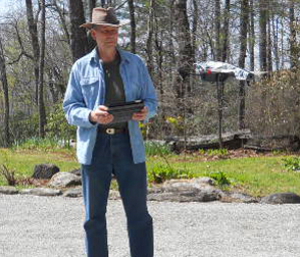
This architectural firm’s cutting edge Site Analysis featured during their Walk Your Land With The Architect services often involves them making Aerial Drone flights with HD videos. Houzz reported on the drone work of Rand Soellner, ArCH, NCARB, Senior Staff Architect for this firm this week.
As reported, this firm began its site reconnaissance drone flights when Rand’s wife, Merry wanted to start shooting aerial drone flights of her real estate listings for her clients. Rand started taking the drone along to his Site Visits for preliminary Site Analysis and discovered that it worked fairly well.
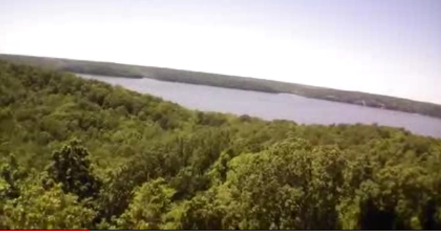
Here is one of the flights, on about a 200 acre site for one of his firm’s Clients:

His firm’s Clients liked the high-flying videos of their land; giving them a perspective they’d never seen before, unless they happened to either own or rent a helicopter flight. Sometimes, the video provided evidence of views that existed of which no one was aware existed, just beyond the tree line.
Many of this company’s Clients have substantial acreage: 100, 200, 700 to 7,500 acres. Having the drone helps to visualize the raw features available. The HD videos also help to prove or discount odd topographic offsets that GoogleEarth sometimes indicates. For instance, on this video above, GoogleEarth indicated a 50′ vertical offset along one area that visually looked smooth. The drone checked and indicated that no such offset existed. It takes a combination of tools to result in more comprehensive data for the Architect to create the project.
Interesting public air flight notes: its been said that TSA frowns on people taking lithium batteries onboard aircraft, so the special batteries used to power the drone has to be US Priority Mailed on ahead to a location where you can retrieve and use that during your visit, then return mail it back to your office, if you intend to board a public flight. These batteries cost about $60 each, so some extra planning needs to be made.
This firm can’t always guarantee that they will be able to include an aerial drone video with your Site Analysis. Some times things happen. Like about a week ago. In Washington State, after all the trouble to get the drone to the Client site, the drone malfunctioned. When Rand pressed LAND, the drone instead shot skyward. It kept going, up over 100′, where fierce mountain winds threw it into a stand of lodgepole pines. Even after searching for a half-hour, the drone could not be found. And even if is would have been, it was stuck up high on a tree, as testified to by the still-broadcasting view from high up a tree. But that’s not usually what happens. Normally, the Architect is able to obtain some nice HD video of that land.
Contact for Site Analysis: Rand@HomeArchitects.com 828-269-9046
tags: drones on Houzz, Cashiers, Highlands, Leavenworth, Atlanta, Aspen, Telluride, Hendersonville, Lake Toxaway, Glenville, Chicago, Wisconsin woods, Cherokee
